Posted On May 1, 2025 | Article By Jordan Furnans
Subsidence Due to Groundwater Pumping
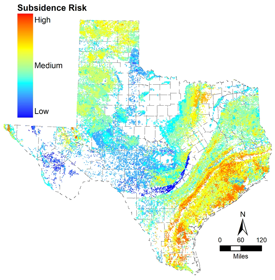
Groundwater has become increasingly important in recent decades, as more than one-third of the population of the United States relies on it for their drinking water today. However, when groundwater is overdrawn due to rapid development and prolonged agricultural or mining activity, land subsidence may occur, which can damage manmade infrastructure and natural environments. As such subsidence is irreversible, it is important to monitor risks at the hyper-local level and switch to surface-water sources if needed before subsidence impacts the local landscape.
What is Subsidence?
When groundwater is pumped too quickly or at too high a volume, the hydrostatic pressure in the ground decreases, which can lead to compression within clay layers and may result in lowering of the land surface. This reduction in elevation of the land surface, called subsidence, is irreversible. Subsidence primarily occurs in areas with aquifers, which are underground layers of permeable sediment and rock where water is stored or passes through. If aquifers are unconsolidated or consist of significant compressible clay layers, the risk of subsidence is greater. However, subsidence can also occur due to accelerated dissolution of aquifer layers, erosion, or void growth (i.e., the creation of sink holes).
Subsidence can cause a wide range of issues. In developed areas where the infrastructure cannot accommodate sinking or flexing land, subsidence can severely damage roads, buildings, sewage lines, and other vital infrastructure. Near the coast, seawater intrusion can convert land into shallow lagoons. Differential land surface elevation changes resulting from subsidence can theoretically alter local floodplains and exacerbate flooding issues, thereby affecting property values and development. Case studies on this subject are being evaluated by numerous Texas regulatory entities and have yet to fully link flooding concerns to groundwater pumping.
Mitigating Subsidence
Subsidence risk should be assessed and monitored over time so water management practices can be altered before significant subsidence occurs. Several modeling tools exist to predict the risk of subsidence, including MODFLOW, PRESS, and a Microsoft Excel-based Subsidence Tool that I helped to develop in 2016. While MODFLOW offers highly precise results and PRESS allows for detailed storage inputs for different depth intervals, our Excel-based Subsidence Tool allows users to obtain site-specific subsidence risk assessments without also having modeling/MODFLOW expertise. This tool is specific to Texas and is freely available from the Texas Water Development Board (TWDB) at https://www.twdb.texas.gov/groundwater/models/research/subsidence/subsidence.asp.
Subsidence Regulations
There is no nationwide law governing groundwater usage to prevent subsidence. Some states have regulations that are applicable, such as the 2014 Sustainable Groundwater Management Act in California, but most states do not. In these states, groundwater is regulated at the hyper-local level. TWDB was established in 1968 to finance public water projects, collect data relating to water quality, and plan for floods or droughts. There are currently 101 Groundwater Conservation Districts (GCDs) at the local level that fall under the authority of TWDB and who must consider subsidence concerns when managing local groundwater resources. GCDs in the same region also collaborate to conduct joint groundwater planning efforts over defined Groundwater Management Areas (GMAs). These GMAs must release 5-yr plans for groundwater development within their regions. Subsidence risk and management reports for the most recent 5-yr plans are due next year.
How Can We Help?
Spheros Environmental combines scientific expertise across air quality, water resources, climate services, ecological sciences, and digital technologies to deliver sustainable, science-based solutions for both private- and public-sector clients nationwide. Our interdisciplinary teams of scientists, engineers, and technicians collaborate on projects that address complex regulatory, policy, and environmental challenges. With services ranging from ecological consulting and laboratory analysis to real-time air quality monitoring and water management, we provide data-driven solutions that support regulatory compliance, mitigate risks, and advance sustainability goals.

About the Author
.jpg/:/rs=w:1280)
Dr. Jordan Furnans has 24 years of professional experience in both field hydrologic data collection and analysis of data through the development and application of numerical models. He specializes in the areas of water right accounting; coupled field and model hydrodynamic investigations of estuaries, lakes, and rivers; water availability modeling; watershed hydrology planning and management; floodplain management; hydrographic and sedimentation survey methods; and freshwater inflow and instream flow requirements for ecosystem health. Dr. Furnans also has expertise in groundwater well design and permitting support.
If you have a need related to subsidence, email Dr. Furnans at Jordan.Furnans@LREwater.com

